How the Largest County in Wyoming Increased Operation Efficiency, Improved Employee Accountability and Built Customer Trust with AgTerra Products

Sweetwater County is Wyoming’s largest county, with over 10,000 square miles of open area. Prior to utilizing AgTerra products, Sweetwater County Weed and Pest mapped and treated invasive weed species using handheld GPS devices, paper, and pen.
In the fall of 2017, they faced increased pressure from the BLM and the Wyoming Forest Division to adopt a complete record keeping system that included digital maps and reports. They implemented AgTerra’s SprayLogger system in 2019 as their chosen tool to to fulfill their needs and meet program standards.
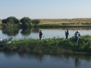
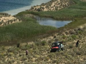
Sweetwater uses SprayLogger with backpacks, ATV’s, UTV’s, and trucks to automatically map invasive species, follow up with treatments, and finally revisit sites to check the effectiveness of applications.
“I was surprised at how much I enjoyed using MapItFast and SprayLogger. While the user interface is deceptively simple, the level of detail we can capture is amazing. I no longer allow any spray work to be done without AgTerra’s SprayLogger system.” – Dan Madsen, Weed Director of Sweetwater County Wyoming
Prior to choosing SprayLogger, Sweetwater investigated several different hardware and software options to fulfill the requirement for digital maps and reports tracking their activity. The decision to go with AgTerra was heavily influenced by the ease-of-use of the system and the high level of usable reported information.
They immediately discovered how simple it was to train their crews and fully integrate SprayLogger into their program. Where other systems required advanced training, the SprayLogger system could be taught to their crews in just a couple hours and they could begin working in the field the same day.
Additionally, generating the much needed digital maps and reports for the BLM and Division of Forestry now took only minutes. Previously, this had involved the laborious task of manually creating reports from scratch.
“While there are other capable systems on the market, SprayLogger combines an extremely easy to use platform with powerful maps, reports and data I can actually use.” – Dan Madsen, Weed Director of Sweetwater County Wyoming
Sweetwater County had run into the common problem of accurately recording information from the field in a way that made it easy to work with back in the office. Using GPS handheld devices was cumbersome and time consuming and any collected information had to be manually input into a database. They found GPS tracks were prone to user entry error and could be arbitrary. As a result, they were unable to pinpoint exactly when and where application occurred or even details about the chemicals that were applied. When SprayLogger was implemented into their program, those issue ended overnight.
“I simply can’t imagine our program without AgTerra. The fact that I can call on them and they know my name, my account and I know them make all the difference in the world” – Dan Madsen, Weed Director of Sweetwater County Wyoming
An unexpected benefit of using the AgTerra SprayLogger system was how it has improved their community relationships. The county is regularly contracted out to do work for private landowners. With the record keeping system provided by AgTerra, not only are customers impressed with the work done, but the county has been successful in proving that applications meet all lawful requirements. This has kept Sweetwater County Weed and Pest safe from inaccurate claims made against them as they were able to show exactly where and when crews sprayed, and what products were applied.
How MapItFast and SprayLogger help manage 10,491 square miles of land in Wyoming
Project Scouting: A supervisor is able to field scout an area ahead of application work, map invasive species, create spray routes and no-spray areas, take pictures, and record notes for various crews using MapItFast.
Job Accountability: When applicators complete job assignments, supervisors are able to double check the work in detail to verify the job was completed to specification and best practices were used.
Customer Satisfaction: Professional digital maps and reports provided to private land owners specifying every detail of a completed job has led to increased trust and more private landowner work.
Insurance: Detailed maps of spray and no-spray activities coupled with automated reports of application areas and chemical use allowed Sweetwater County to demonstrate that crews were operating within USFS and BLM guidelines and parameters.
“The information collected has proven invaluable to use on more that a few occasions where others have tried to lay a case against us.” – Dan Madsen, Weed Director of Sweetwater County Wyoming

Sweetwater also discovered that with AgTerra’s products in hand, a small group of supervisors could manage multiple, large crews. Utilizing MapItFast, the county weed director could go ahead of the crews on an ATV, or fly a drone, and map areas of concern.
Additionally, detailed notes and pictures could be easily uploaded and sorted into projects for crews to review and act on, all from the field.
The dramatic decrease in desk time has enabled supervisors to cover far more ground in the same amount of time as in years past. It has also made work crews more efficient with their time and resources as they are no longer visiting unnecessary areas.
Moving forward Sweetwater County has plans to increase their understanding and of AgTerra products and dig deeper into their functionality. They have exciting ideas for ways to further streamline other areas of their operations. They see their partnership with AgTerra as in invaluable tool to help them use tax payer dollars as efficiently as possible.